
On Friday the 11th of March 2011 an magnitude 9 earthquake occurred off the coast of Tohoku, it was the most powerful earthquake ever recorded in Japan. This triggered a tsunami which hit the Tohoku coastline killing thousands. The tsunami also hit the Fukushima Daiichi Nuclear Power Plant setting off 7 nuclear meltdowns. Thousands of people had to be evacuated and many still have not been able to return to their homes.
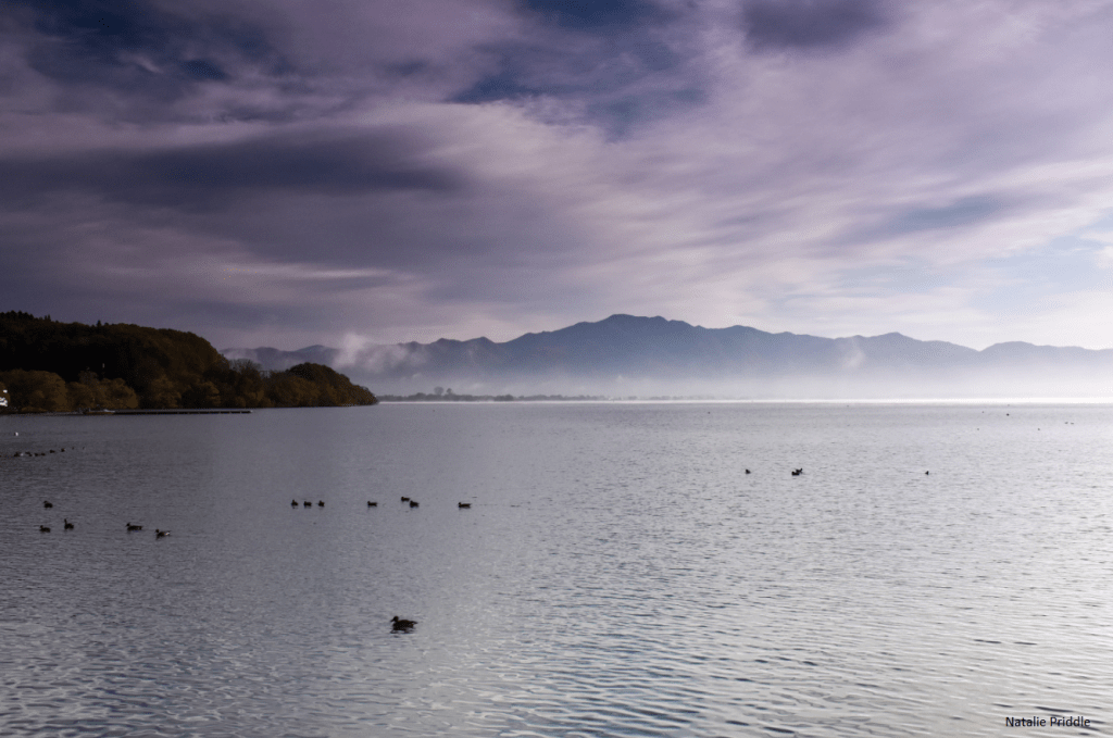
Although often termed as “dark tourism” I wanted to go and visit some of the newly opened towns, and see the nuclear exclusion zone 8.5 years on from the disaster. There are now a couple of tours you can pay to go on to visit the area, but tours are not my thing, so I planned a route by myself. There is increasingly more information available online about the newly opened areas, Tomioka and Namie, which were our destinations for the day. Google said the drive would by 2 hours, it was 4! Our first stop to break up the drive was Inawashiro lake, just east of Aizuwakamatsu. We pulled in to a parking area on the northern shore at Nagahama Okinasawa. There were the usual tourist boats on the pier, but the area looked very run down, as if it used to be popular but has declined over the years. A lot of rural Japan has suffered this fate but I wonder if, as it is in Fukushima, the impact has been greater.
We drove for another hour before stopping off at a 7/11 for some snacks and a little walk around the small town we found ourselves in. Another hour of driving, this time a Family Mart, before the final hour stretch got us to Tomioka Station.
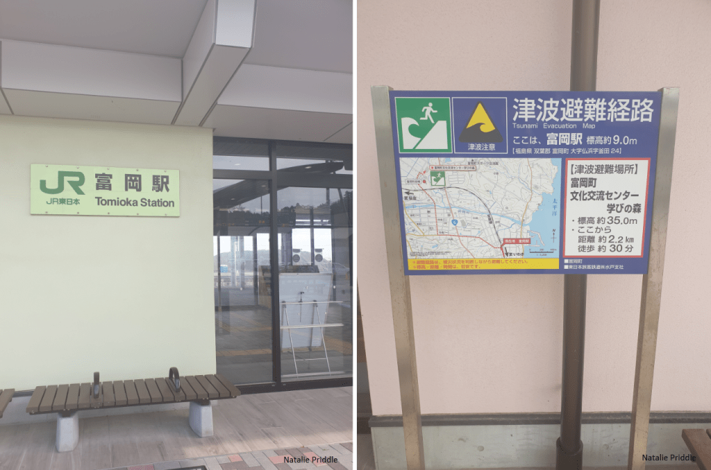
Tomioka Station was destroyed by the 2011 tsunami as it sits only a few hundred meters away from the shoreline. The Fukushima Daiichi Nuclear Power Plant is located within Tomioka city, roughly 10 km away. The town and station suffered extensive damage from the earthquake and tsunami which followed. The city had to be evacuated on March 12 as it was within the exclusion zone from the nuclear power plant. The zone was lifted by the central government in 2013 but was reinstated by the elected town government for a further four years, until 2017. The town is now open, but a large number of the houses are in the condition they were when the power plant went into meltdown.

We went into the station and purchased some local produce and items in order to support the town, before heading north. The station area was sparkly and new, everything was perfect. Just a little way away from the newly opened station were more abandoned areas.

We headed towards the northern part of Tomioka town called Yonomori. Tomioka never was a huge tourist draw, but the most popular draw was the 2km sakura tree lined main road in Yonomori. Although Tomioka was opened in 2017 many areas still remain designed at “difficult to return zones” as they have high levels of radiation. The whole of the sakura lined road is now accessible, and west of the road is now returnable, whilst east of the road is still strictly off limits.

The trees were obviously barren in November but you can imagine how this would look in full bloom during spring! At the northern end of the 2km stretch of cherry blossoms it reverted to a no-go zone and was guarded and fenced off. In the picture below the land to the left is safe and the land to the right is not safe!

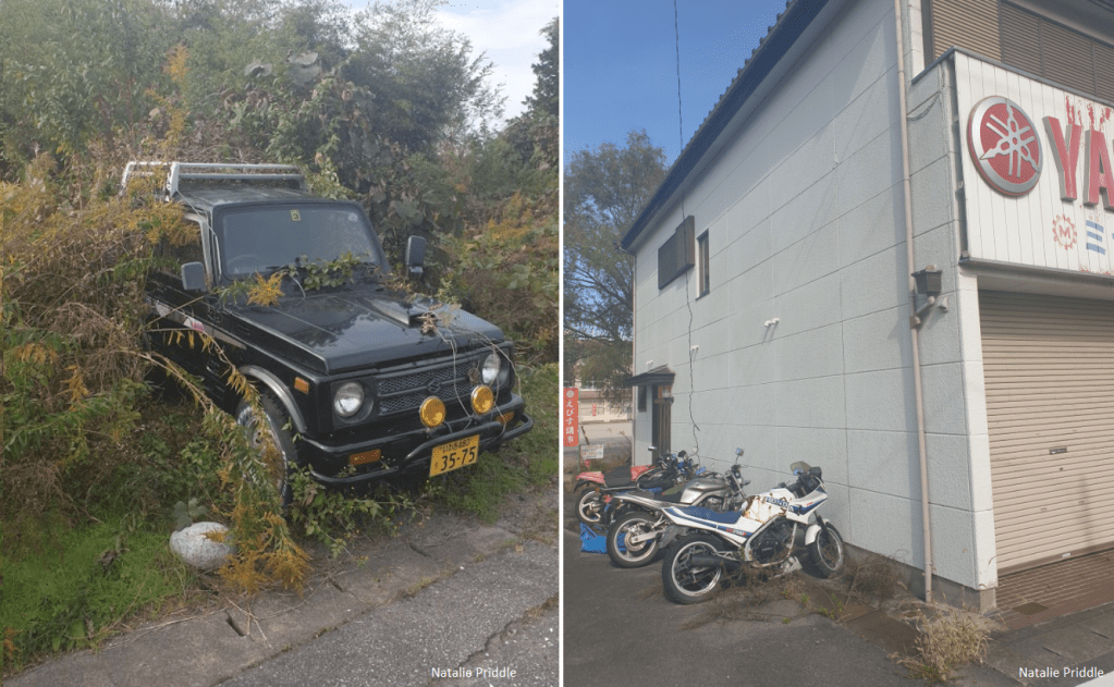
We walked around this area for a while, there is a school nearby with the standard Geiger counter, and more counters were placed in the no-go zone, visible from the street. It is so saddening to see so many houses, and think of the numerous families who are not in their homes. To see all the cars, and bikes and day to day items which have had to be left behind, now too radioactive to be used again.


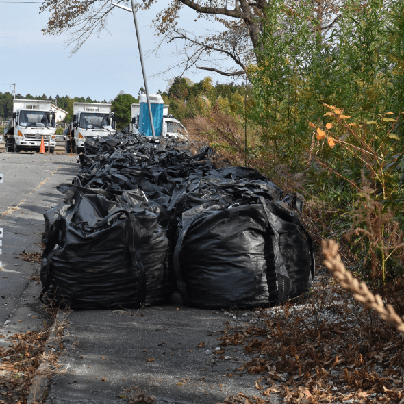
This was our first up close experience with the ubiquitous black bags in Fukushima. If you have seen any footage regarding the clean up effort you have probably seen these large black bags. The bags are filled with contaminated soil dug from radioactive areas in order to decontaminate. The bags are then taken elsewhere (which is becoming a new problem) in order for the original area to be safe for people to return.
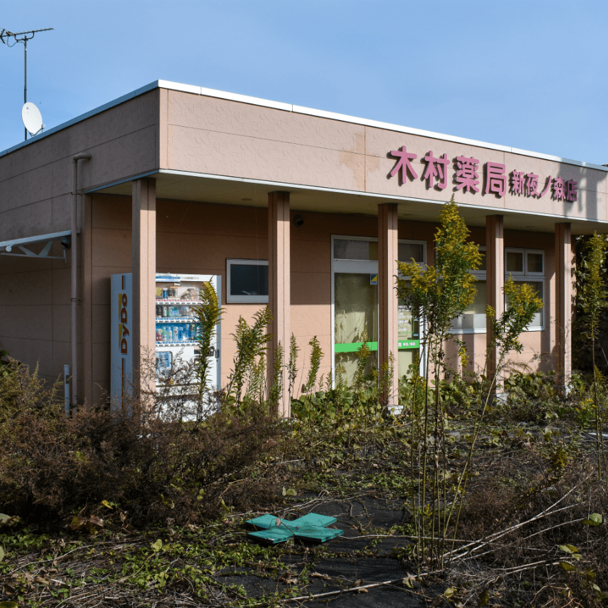
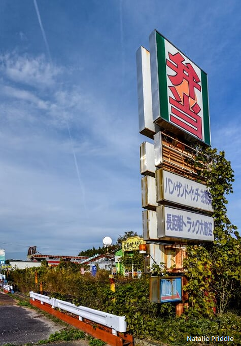
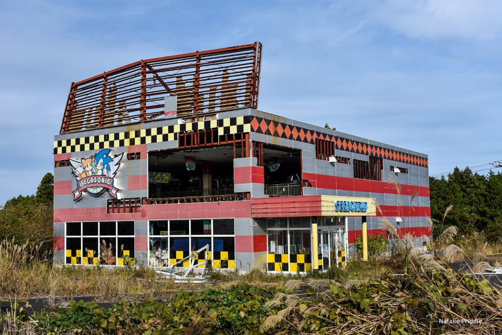
After taking a walk around the area we headed north on route 6 in order to reach Namie. Route 6 will also take us past (as close as you can get) the Fukushima Daiichi Nuclear Power Plant. We ended up stopping in Shinyonomori Motooka, a part of route 6 lined with restaurants, shops and arcades. Along this stretch of the road both sides are cordoned off as no-go zones, but we found a small lay by to tuck into (you can see our Nissan Note in the shot below) so we could look at the buildings in the area.
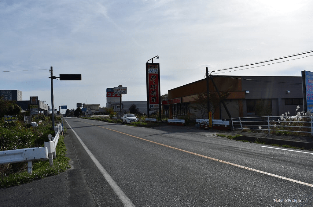
We were a little concerned about whether it was okay to stop here, as both sides of the road were no-go zones, but even when the Police and a security van drove past we weren’t challenged. The whole area was destroyed and completely overgrown. It’s hard to tell now so much time has passed what caused some of the damage, whether the initial earthquake or just the passage of time. Windows were broken, ceilings fallen in and anything unprotected gone to rust.
Alongside the road here there was a much bigger collection of radioactive black bags. You can see how they pile them up and cover them with green once they have a few hundred!
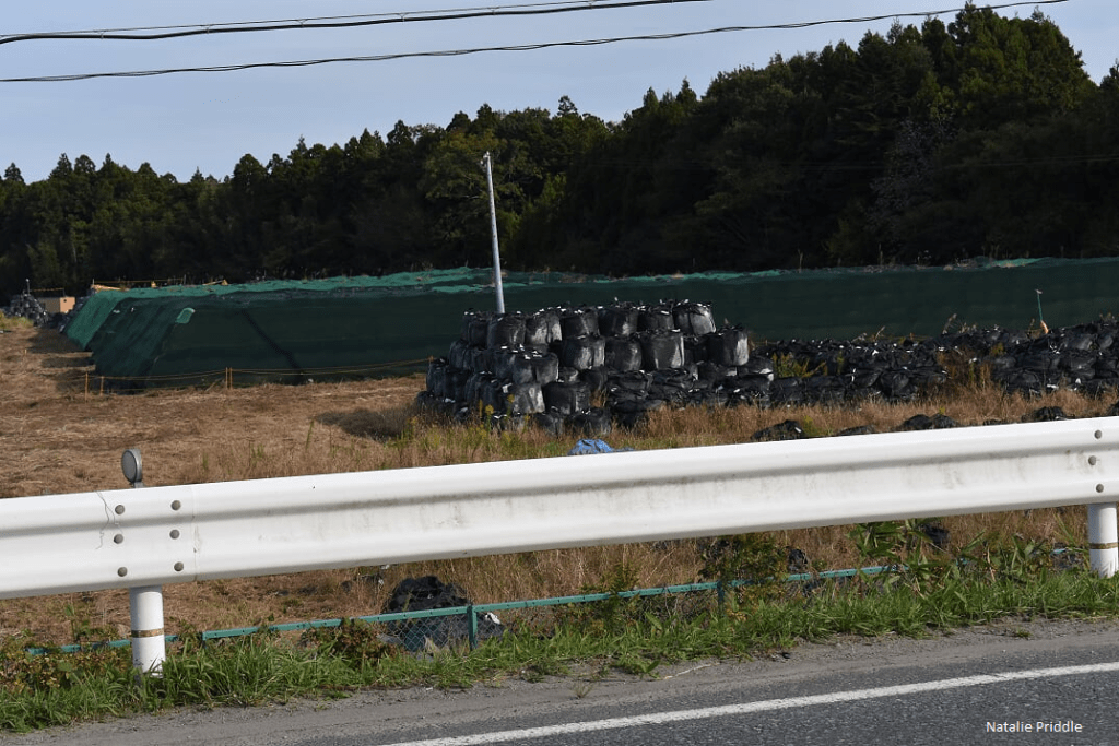
We continued up route 6 and on the entire 20km stretch we drove up you could not turn right at any point. The land to the right of the road was all a no-go zone, unsuprising seeing as the road is the closest to the Nuclear Power Plant you can get, 2km away.

From the road the plant is obscured by the tree line however you are able to see the cranes which are working on the site. Along the road were Geiger counters, the radiation level here was only 1.7 µSv per hour. This level is below the average natural radiation level, so is quite safe to drive through. Our aim in Namie was to visit the Namie Choritsu Ukedo Elementary School. It was a real challenge getting here thanks to all the closed roads. And the fact that the land to the west of the school is now a radioactive waste dump! The dump contained the standard black bags, but also cars, buses, bikes and other daily items which are too radioactive to go anywhere else.
Namie Choritsu Ukedo Elementary School which being located almost directly on the beach itself (200 m away), was fully submerged by the tsunami. There was only 50 minutes between the earthquake and tsunami, luckily the school staff ignored protocol and instead of keeping the children inside, evacuated to a nearby hillside. Not a single student or member of staff died in the earthquake or tsunami, thanks to the actions of the teachers.

The school was fenced off but you are able to walk around the whole school, you can see the power of the tsunami waters when you look at the western end of the building. You can see lots of debris from throughout the school piled up at the western end of the building. There is shattered concrete and bent rebar showing how strong the wave must have been as it passed.


The clock on the tower was radio controlled and stopped the second the electricity was cut out by the tsunami, that moment is now frozen in time.

From the school we could see the newly built sea wall and the sluice gates but in to allow the rivers flow. We walked up along the sea wall heading south, on the horizon you could again spot the cranes at the Nuclear Power Plant.

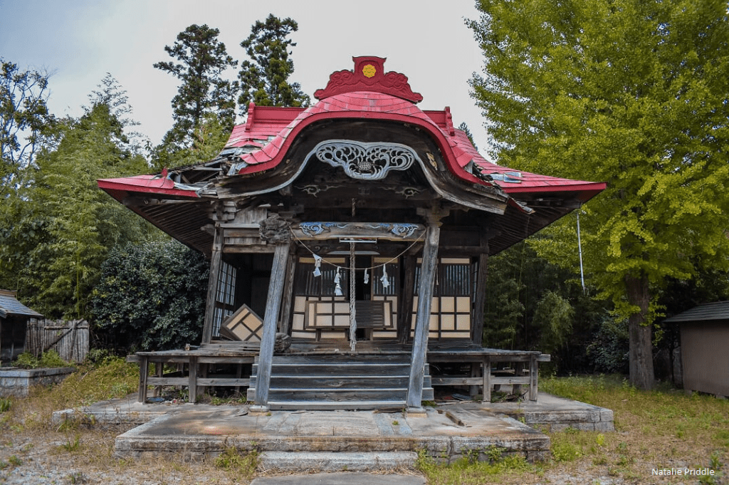
On the sea side of the wall thousands of pine trees were being planted, just like at Rikuzentakata. It was getting late and with a 4 hour drive ahead of us we headed west, back to Aizuwakamatsu. On our way out of town we drove past a dilapidated shrine, the torii gate had snapped and the shrine had become wonky. Even the gods were in the no-go zone.
Once we left Namie we thought our radioactive adventure was over, it was not. We were taking route 50 back to Aizuwakamatsu, but before we joined the road we came to a cordon. Huge flashing lights, lots of guards and warning signs in English. They said: Drive as quickly as you can and do not stop!
We didn’t realise that we were driving back through the most radioactive part of the ongoing Fukushima disaster. The wind on the day the plant melted down sent the radioactive material north west, covering vast mountainous regions. It was this region we were now headed through. It was certainly exhilarating. No one was allowed to return or stay in this area, we drove past dozens of abandoned farms, half of the road was impassable due to mudslides which remained as they were, and we didn’t see another vehicle for 30 minutes! It was here we found the highest level of radiation, reading at 2.6µSv per hour!

It was a long drive, but incredibly worth while and I am so glad I got to visit these newly opened areas for myself and try to support the local economy in a small way. If you can, go visit Tomioka or Namie!


Great post 😁
LikeLike
Thank you 🙂
LikeLike