
After a great sleep at APA Hotel Aomori Ekihigashi we set out at 5am to do the short walk to the JR Aomori station. We were booked onto one of the first shinkansen that went direct to Ichinoseki that morning, to start our second road trip in Tohoku. This was a first for me in Japan, getting to a train station before it had opened! We queued up with a bunch of other tourists, laden with suitcases, for the station to open. As we had booked our shinkansen tickets the day before we only needed to show our passes at the gate to get onto the train to Shin-Aomori station.
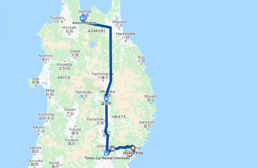
We had some time to kill at Aomori station so got some warm drinks from a vending machine and watched the sun rise. This mornings shinkansen ride was to be the first one where we had to have our bags in the foot well of our seats, sitting squished up for the 1 hour journey to Ichinoseki in Iwate prefecture. The journey passed quickly while we semi-dozed in our cramped seats and soon we popped out in our next prefecture. Again we had rented via Times Car Rental, they had a 40% off autumn sale for prebookings, and so worked out rather cheap to use for our whole trip. This time we got a cute little Nissan Note with high tech reversing 360 degree cameras!
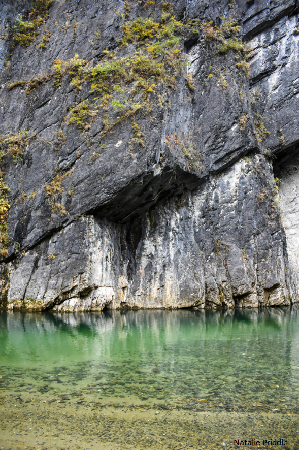
As usual our first stop once we had a car was a konbini for supplies, before heading off to our first sightseeing spot in Iwate, Geibikei Gorge (Two gorges in two days!). Geibikei gorge is said to be one of the top gorges in Japan, with high sides and clear water. Here we met our second old lady parking assistant, who directed me into a space before explaining that it was free, as long as we bought something in their shop before we left.

The entrance for the gorge boats was more organised that I had assumed, with a proper ticket booth before going further in. The attendant was very excited that we were from the UK. Maybe due to the fact that of the three boats (which hold 20+ people) we were the only Westerns there that morning. We were quickly shepherded onto a waiting boat that was almost full, and our gorge journey began.
Mother nature was having a laugh at our expense again and the recent typhoons had damaged the gorge. The usually picturesque sides were often piled with sand and debris, and where the boats stop to let you explore further up the gorge, there was a huge JCB in the river moving silt around!

It was still quite beautiful, although I imagine it would have been much more beautiful on a sunny day. Even after the typhoon and flooding the water was still really clear and you could see the bottom of the stream as you gently went up the river. The highlight of the whole trip was the boatman singing a traditional song which echoed beautifully through the gorge.
After our peaceful cruise up Geibikei gorge we jumped back in the car (once we had visited the old ladies shop and purchased a little something) and headed towards the coast. One of the biggest reasons for travelling to Tohoku was to visit the eastern coastal regions affected by the 2011 Great Eastern Earthquake and Tsunami. Our first stop along the coast of Iwate was Rikuzentakata which was absolutely devastated by the tsunami.
The town of Rikuzentakata sat in a wide valley which completely flooded during the tsunami, with very little remaining once waters receded. It was quite shocking driving through the valley and realising that the empty, flat land used to contain myriad of houses. Even over 8 years later there is very little in Rikuzentakata, other than a lot of construction work. When we visited there were a couple of blocks of flats which were for the construction workers, and three buildings which survived the tsunami. The one thing that dominates the landscape is the new sea wall which stands across the entire mouth of the valley.

As you travel around the tsunami affected areas you will see a variety of tsunami signs. The small one on the left indicates that where you are was in the path of the tsunami. The type of sign on the right shows how far you’ll have to travel parallel to the coast to be out of the path of the tsunami. It is actually quite scary to be walking or driving around these areas, realising how much of the coastline was hit.
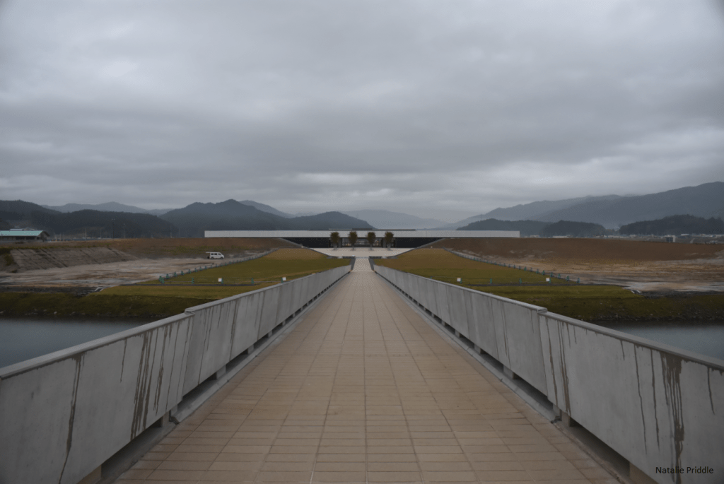
Days before our visit a brand new memorial museum was opened in Rikuzentakata to honour those killed and displaced by the 2011 tsunami. The museum, as seen above viewed from the sea wall, is sleek and modern. As it was new, and it was a rainy day, there were barely any people there, and certainly no other Western people at all. The museum had quite an impact on me, inside were pieces of everyday life salvaged from the tsunami. Two pieces really stuck with me, one a fire rescue vehicle which was slammed into trees, and the second a metal girder from a bridge which was completely bent. There are two films playing in the museum, and an area recreating the disaster response HQ. Perhaps one of the most difficult parts of the whole museum is the area dedicated to lessons from the tsunami. In this area they investigated the reasons that people died e.g. from believing that a tsunami would never be over 3 floors, or that the initial small tsunami was the end. It also discussed how a number of families lost multiple family members trying to convince elderly relatives to evacuate, but not before they were all caught in the path of the tsunami.
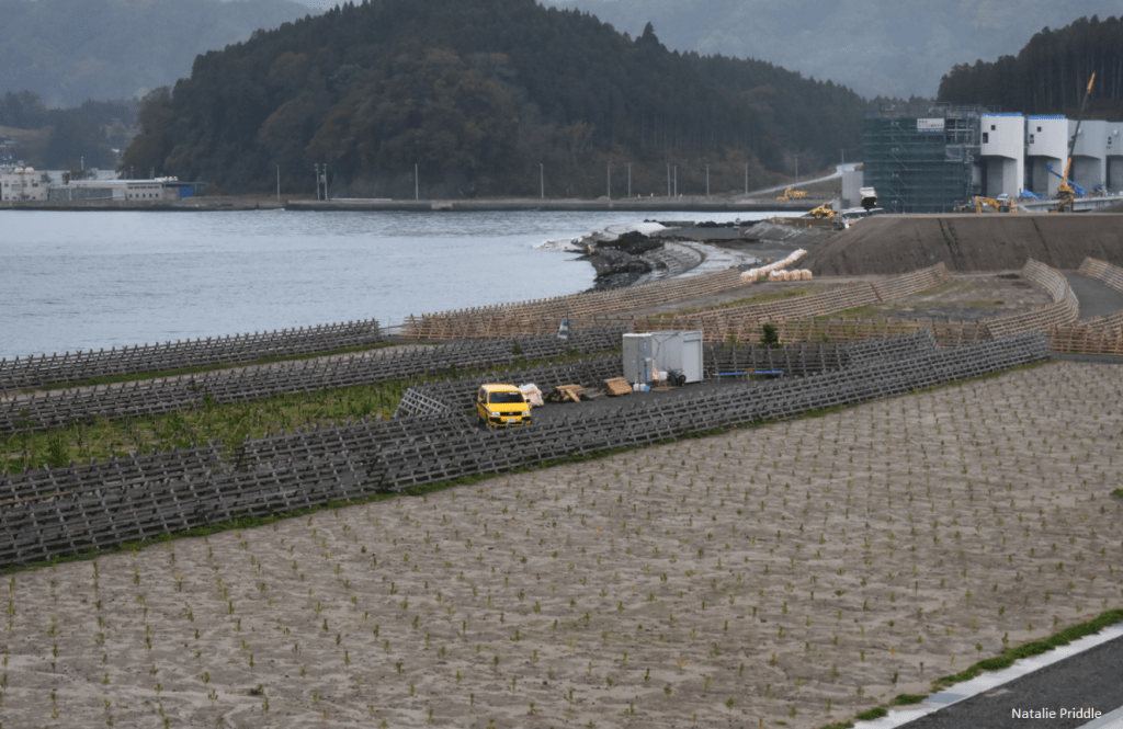
The coastline of Rikuzentakata was famous for the hundreds of pine trees which lined the shore. Only one survived the tsunami, although it subsequently died due to the salt in the soil. Along the shore you can see hundreds of new pine trees planted right against the sea, behind the new sea wall.

Before the miracle pine, which survived the tsunami, finally died a cast was made of it. Today stands an exact replica of the pine tree, in the exact spot the tree stood in life. You cannot tell at all that it is not a live pine! It is a beautiful memorial to the people of Rikuzentakata.

There are two main structures which survived the tsunami across the coast. One is the Tapic 45 building, a michi no eki (roadside station) servicing those travelling up and down the Sanriku coastline. Perhaps the strange shape of the building helped to save it, facing the sea was an amphitheatre style area which meant the tsunami washed up and over the slope. This building is now going to be preserved for prosperity, and sits just next to the new memorial museum.
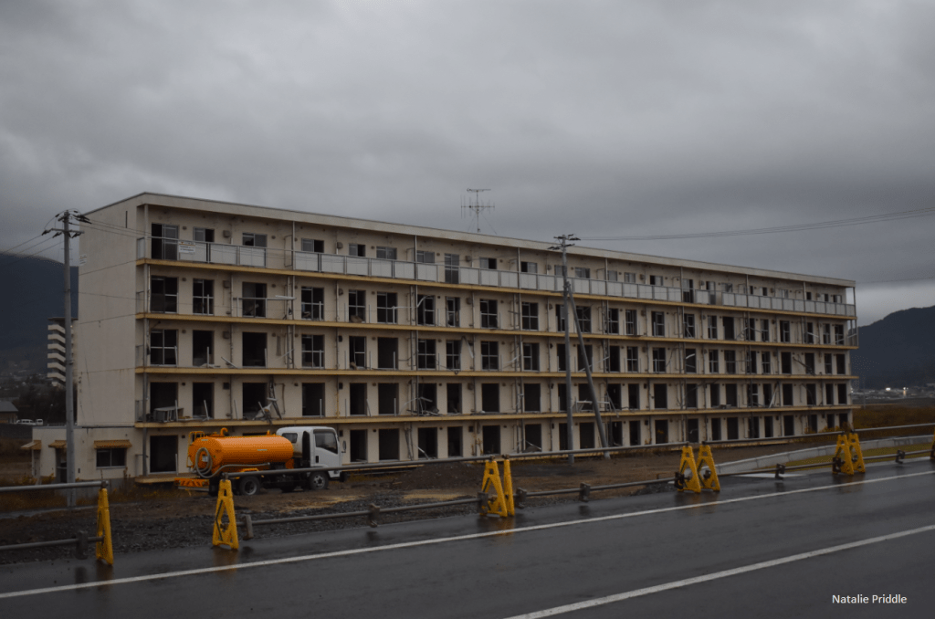
The second main surviving building is a five story apartment complex, a kilometre or so north up the coastline. On the top left of the building you can see a sign which denotes the height of the tsunami when it hit the building. The bottom four floors were completely engulfed and the top floor was shot through with tsunami water. I’m not sure whether this building is going to be demolished or not, but it shows the human cost of this natural disaster. Standing near the building, it is hard to imagine how so much water swept up from the sea.
I am really glad I visited Rikuzentakata, although I have watched many documentaries and series about the tsunami and the victims, nothing compares to standing there and seeing the scars on the land after years have already passed. It was a sobering experience but something any Japanophile should do. One way we can help is to support the local communities with tourist spending, something else Tohoku has lost since 2011. Before leaving we bought some local produce at the new michi no eki (roadside station) attached to the memorial museum.
Understandably there were no hotels in Rikuzentakata so we drove south to Kesennuma in Miyagi prefecture to stay the night. On the drive we went up and down many hills and valleys, always followed by tsunami signs showing the vast areas the tsunami touched.


One thought on “Japan 2019 Day 5: Geibikei Gorge & Rikuzentakata”